Category: Move
Citation
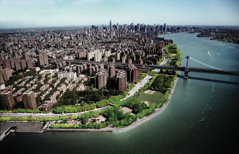
Across its 520 miles of waterfront, New York City has to negotiate competing pressures: Making these sites more publicly accessible and integrated into the urban fabric, while taking into account the threats posed by rising sea levels and storm surges. The master plan for the East River Blueway, designed by New York’s WXY Architecture + Urban Design, takes on both challenges at once.
The site, which runs along Manhattan’s East Side between Midtown and the Brooklyn Bridge, has long been a patchwork of different architectural and infrastructural scales and varying levels of accessibility. The components of the completed Blueway master plan will take years to build, but the plan itself aims to create more of a cohesive experience for the area. An esplanade will allow for continuous pedestrian and bicycling circulation. At East 14th Street, where a Con Ed power station remains vulnerable to flooding, WXY’s design would raise the esplanade over the FDR Drive, stitching together what had been disjointed sections of public space and providing critical flood protection for the important energy infrastructure.
At different points along the Blueway design, the architects include sites that enhance recreational experience and encourage waterfront access. A Brooklyn Bridge beach, for example, would restore a natural beach beneath the iconic span while a floating dock off Stuyvesant Cove would introduce a park program and a launch for non-motorized boats. Throughout the site, landscape elements would attenuate wave action, restore wildlife habitat, and help to manage water runoff.
See all of the winners of ARCHITECT’s 2013 Annual Design Review here.
For more projects by WXY architecture + urban design, please visit ARCHITECT’sProject Gallery.
Project Credits Project East River Blueway Plan, New York
Client Manhattan Borough; New York State Department of State, Division of Coastal Resources
Architect WXY Architecture + Urban Design, New York—Claire Weisz, Mark Yoes, Layng Pew, Adam Lubinsky (principals); Adriel Mesznik, Alice Shay, Chat Travieso, Jacob Dugopolski, Justine Ala, Kennedy Howe, Maiko Shimizu, Marcus Hooks, Mia Pears, Paul Salama, Shachi Pandey, Stephanie Koltun (team)
Structural Engineering Weidlinger Associates
Landscape Architecture Judith Heintz, Glenn Smith
Permitting Outreach AKRF
Infrastructure Engineering ARCADIS
Lighting Design Domingo Gonzalez Associates
Water Resources, Environment and Ecology eDesign Dynamics
Economics and Implementation Strategy HR&A Advisors
Transportation Planning, Civil Engineering, Land Ownership, and Permitting Philip Habib and Associates
Size Approximately four miles of waterfront