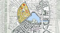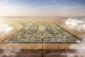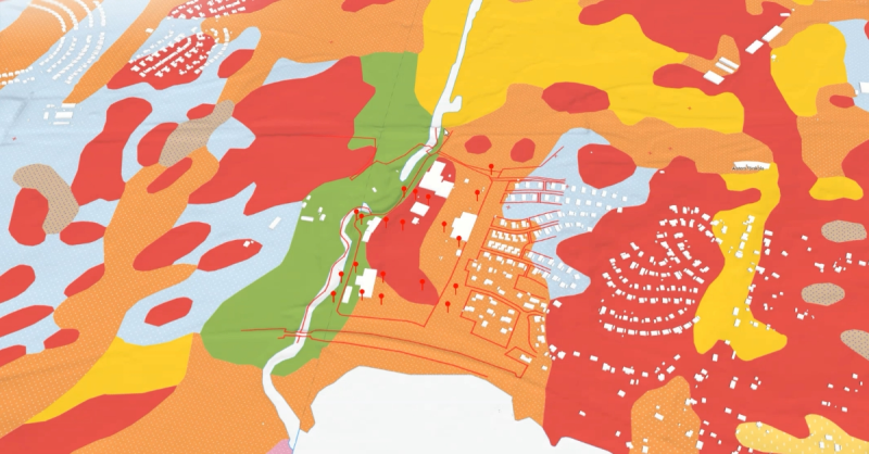
For decades, architecture and planning teams have worked to balance two competing needs: understanding the fine-grained detail of a project while also considering its broader urban, environmental, and social context. Too often, those perspectives exist in separate workflows. Design data lives in one place, contextual information in another, and critical decisions are made without a complete understanding of how projects connect to the communities and environments around them.
A recent presentation by Adam Sjödin, Urban Planner and Digital Strategist at Sweco Architects in Sweden, explored a different approach: using geographic information systems (GIS) to treat location-based information as a common language that connects people, data, and decisions throughout the planning and design process.
This shift is becoming increasingly important as governments, cities, and developers seek digital continuity across the entire built environment lifecycle. Rather than managing information in disconnected phases, there is growing interest in using geospatial concepts to create a “digital thread” from early land use concepts and planning through permitting, construction, operations, and long-term asset management.
A key challenge is that architecture, more than ever, depends on information from many different stakeholders. Designers must consider mobility, environmental conditions, infrastructure constraints, community priorities, economic development goals, and regulatory requirements alongside the design itself. Early-stage planning requires both detailed project information and citywide context. Yet detailed building models and broader geographic datasets are often handled separately, limiting collaboration and slowing decision-making.
The solution presented was not about replacing architectural design tools. Instead, it focused on using GIS concepts to create a shared spatial understanding where project teams can integrate detailed design information with broader spatially accurate data. By bringing building information, planning proposals, technical investigations, and geographic datasets into a common GIS environment, teams can improve coordination, visualize impacts more effectively, and make better-informed decisions.
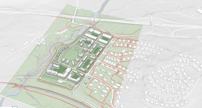
Several real-world examples illustrated the value of this approach.
- One project demonstrated how combining building-level design information with urban-scale data helped planners evaluate development concepts within their larger city context. Rather than viewing a project as an isolated site, stakeholders used GIS to understand how design decisions related to surrounding neighborhoods, infrastructure, and environmental conditions. This created a stronger foundation for technical coordination and early-stage planning.
- Another case study focused on public spaces. Traditional observation methods rely on paper-based surveys and manual data collection, making it difficult to analyze results or connect findings to other planning information. By using location-aware digital field workflows and geospatially referenced observations, planners were able to collect evidence more efficiently and gain deeper insight into how people move through, use, and interact with public spaces. The result was better information to support future design and planning decisions.
- A third example addressed a challenge faced by many cities: understanding the relationship between climate action, public health, and urban transformation. While projects often generate multiple benefits, those outcomes are difficult to measure, compare, and communicate across organizations. By creating a citywide project hub that combined maps, dashboards, surveys, and open data, stakeholders could better identify, track, and communicate projects that contribute to healthier and more resilient communities.
Collectively, these examples point to a broader trend in architecture and planning. The future is not simply about creating more data; it is about using GIS to make data more accessible, connected, and useful. When information is grounded on real-world content, it can move more freely between disciplines, and project teams gain a shared understanding of place. Designers can see beyond property boundaries. Decision-makers can evaluate trade-offs with greater confidence. Communities can become more informed participants in the planning process.
The ultimate outcome is architecture that is more responsive to its surroundings and more capable of addressing the opportunities and challenges of a site. As design teams gain access to richer contextual information, they are better equipped to create places that are resilient, sustainable, and grounded in the needs of the people who use them.
Learn More
Architecture has always been about connecting people to place. As projects become more complex and expectations continue to rise, firms should examine how geospatial thinking can strengthen collaboration, improve decision-making, and provide the context needed to create better outcomes. The organizations that successfully connect design, data, and place will be better positioned to shape the next generation of resilient and thriving communities.
Discover innovative approaches to early-stage design through the integration of GIS, BIM, and open data in this recorded webinar with Sjödin.