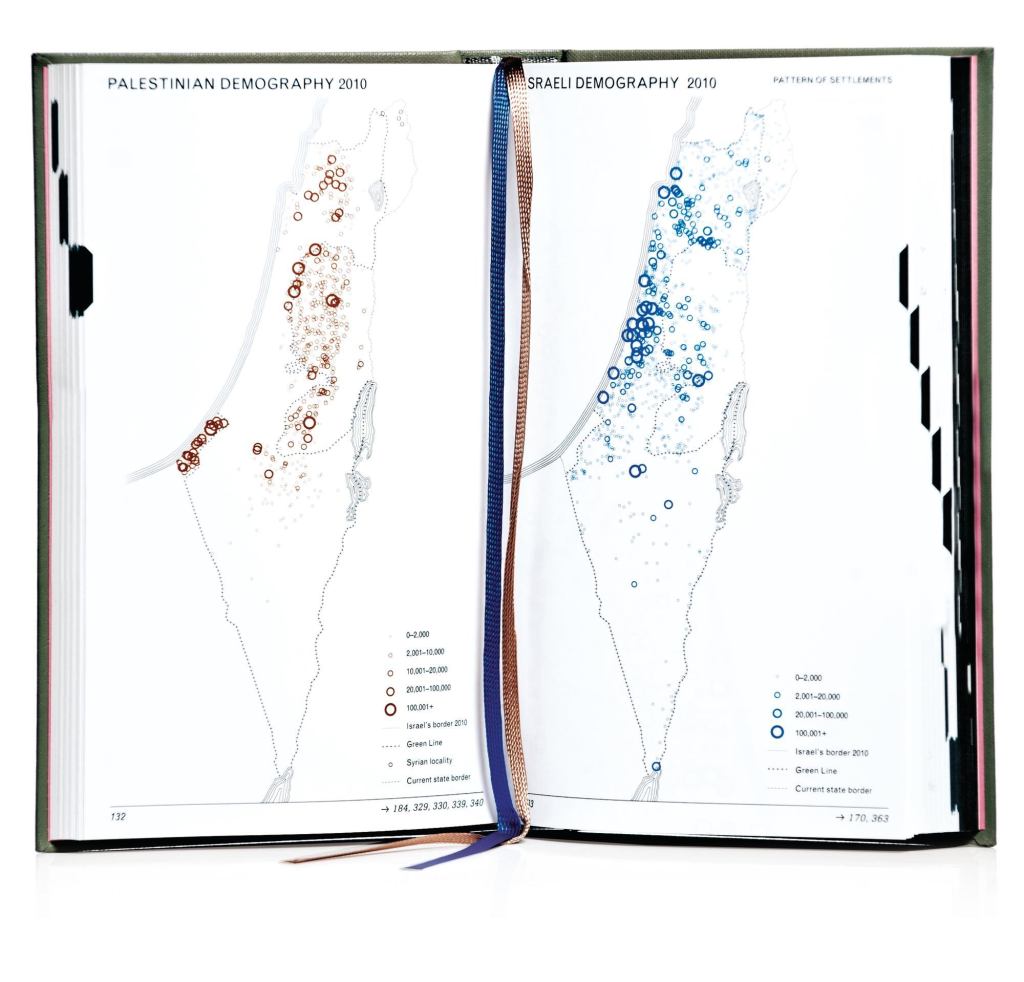
In 500-plus maps, Malkit Shoshan’s Atlas of the Conflict: Israel–Palestine tracks the geographic fluctuations of Israel from the Iron Age to today. Palestinian territory has typically declined in proportion to Israeli growth along various vectors: e.g., Israeli archaeology waxes where Palestinian populations wane. The maps present the conflict as it has unfolded, revealing a war waged through geography—with settlement typology playing as significant a role in the fates of Israelis and Palestinians as the wall now separating them. • $51.50; 010 Publishers
Book: Atlas of the Conflict: Israel-Palestine
Mike Morgan