In 1811, when Simeon De Witt, Gouverneur Morris, and John Rutherfurd were commissioned to create an urban plan for the island of Manhattan, they came up with a fairly soulless solution. Their grid lacked parks and plazas. Streets cut through private property, much of which the government appropriated. Though some streets remained unfinished for decades, the grid ultimately sent property values soaring by lending the city a density and navigability. It also left the flexibility to accommodate Central Park. Celebrating the bicentennial of that feat, The Greatest Grid: The Master Plan of Manhattan, 1811–2011, on display at the Museum of the City of New York, offers prints, maps (an 1811 map by John Randel Jr., the original surveyor, shown), and photographs that chart the city’s evolution. Through April 15. • mcny.org
Exhibit: ‘The Greatest Grid: The Master Plan of Manhattan, 1811-2011’
1 MIN READ
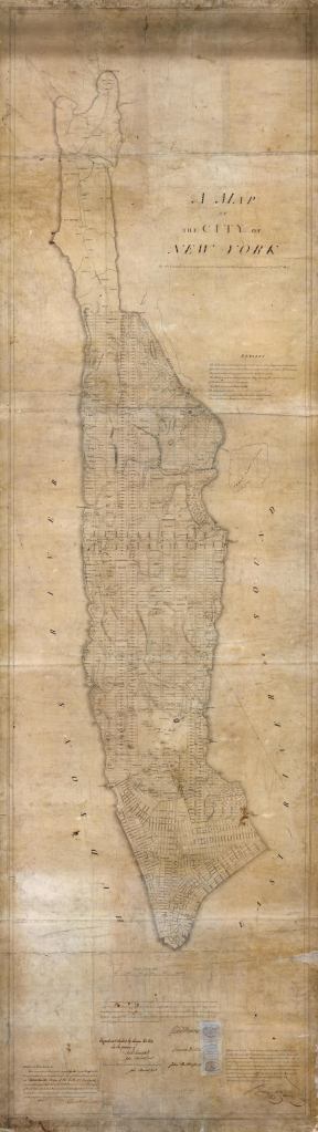
Courtesy the New York City Municipal Archives