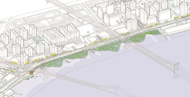
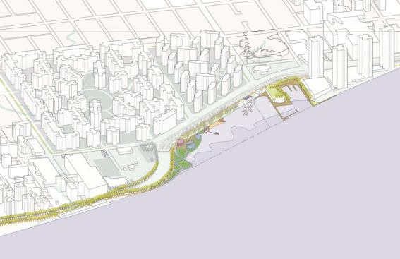
Courtesy WXY Architecture+ Urban Design
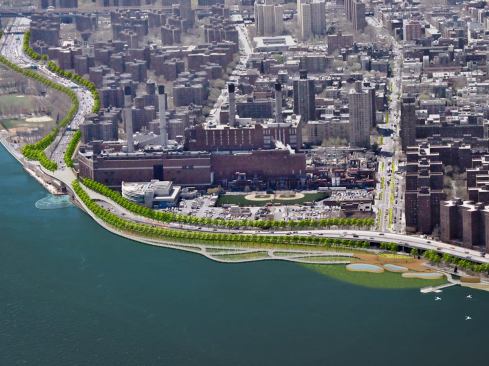
Site Plan for the East River Blueway proposal stretching from Br…
In the wake of the devastation left by Hurricane Sandy last October, New York has announced a new plan to combat stormwater surge should the city suffer another such storm. Developed by New York-based WXY Architecture + Urban Design, in concert with local officials and community groups, the East River Blueway Plan was announced by Manhattan borough president Scott Stringer, and calls for the creation of storm water barriers along a 4-mile-stretch of the East River waterfront.
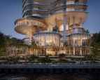
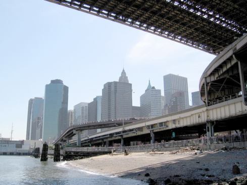
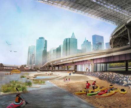
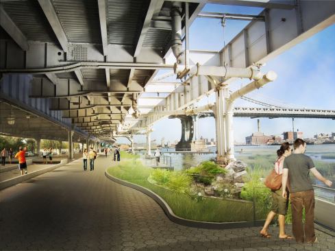
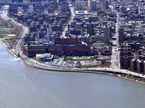
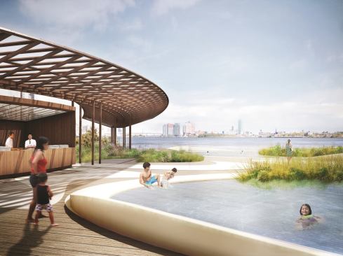
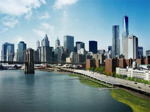
The plan, which has been in development since 2011, calls for the creation of wetlands, parks, bicycle and pedestrian pathways and bridges, and the redevelopment of a disused beach under the Brooklyn Bridge. “We’re looking at how to bring the East River back, how to make it great from a habitat point of view,” says WXY principal Claire Weisz, FAIA. The plan also proposes raising the existing park road and replacing a bulkhead that currently blocks access from FDR Drive to the river. Instead of being blocked by solid infrastructure, storm surges would be mitigated and absorbed by the natural buffer of wetlands that extend into the river, and residents would have better access to the waterfront.
The Blueway plan fills in the gaps left between existing infrastructure development plans—including the East River Esplanade designed by SHoP Architects and Ken Smith Landscape Architects, the first phase of which opened in 2011—and will complete the East River Waterfront up to 38th Street. “There was a need for continuity,” Weisz says.
Stringer announced the plan in his State of the Borough speech, where he also pledged $3.5 million toward the construction of the wetlands, jumpstarting funding for the project. The wetlands will extend into the river and create a natural edge to the city, rather than a line of bulkheads which, over the years, have served to increase water speeds in the river, and to cut off access for area residents to the waterfront. “The design was really based on ideas that came from community activists and residents who really understood how the river worked,” Weisz says.
Other flood-prone cities have also turned to wetlands and greenways to help absorb storm water surge, including New Orleans after Hurricane Katrina. In New York, the hope is that “you potentially get protection of utilities and you get this connection that people have been looking for along the East River,” Weisz says. The plans balance of disaster preparedness with creating new amenities “really underscores the idea that you really can’t just build back exactly the same. You have to make these places well-loved by people, but also protected. They can also help protect where people live.”
The full Blueway Plan report is set to be released soon, at which point the project can move forward with further community review and development. And though the project has been in the works since long before Hurricane Sandy hit, the timing is right for the new plan to get underway. “We did this plan after Hurricane Irene and this place was inundated by water,” Weisz says. “The workshops and the people planning this did understand.” But what the devastation wrought by Sandy did was “give us the opportunity to move the focus onto the aspects of the plan that really helped with resiliency and to get more support for them,” she says. With the East River Blueway plan, WXY was intent not just on fixing existing problems, but “creating a vision that was ambitious about the long term,” Weisz says. “If we’re repairing our infrastructure how can we make it better.”