The proposals by 10 high-powered interdisciplinary design teams, led by firms such as the Bjarke Ingels Group (BIG), Interboro Partners, and Office for Metropolitan Architecture (OMA), all have a great deal in common. Each team participating in the federally funded Rebuild by Design challenge, an initiative to create a more resilient New York metropolitan region, focused on a particular geographic location —the south shore of Staten Island, for example, or the city of Hoboken. Most of the teams took a cookbook approach, mixing soft and hard strategies for absorbing and channeling storm surge, and developed proposals that offer a menu of water management tools: deployable floodgates, berms, swales, and levees. The final proposals were unveiled on April 3 at events in Jersey City and Lower Manhattan. The next day, the jury—chaired by federal Housing and Urban Development (HUD) secretary Shaun Donovan and project advisor Henk Ovink (imported, like many team members, from the Netherlands)—started its deliberations to pick the winning designs. According to a HUD spokesman, the judges may choose to implement several of the proposals, with federal disaster relief funding available for (at least) the initial stages of the selected projects. Expect an announcement at the end of April.
The Rebuild By Design proposals don’t feature monumental objects or extravagant built form, which makes them poor fodder for the architecture press. At the same time, many of the suggestions seem reasonably easy to implement, even by local governments. Rather than summarizing each proposal, we thought it would be more interesting to highlight 10 of the strongest ideas that emerged from the teams’ research.
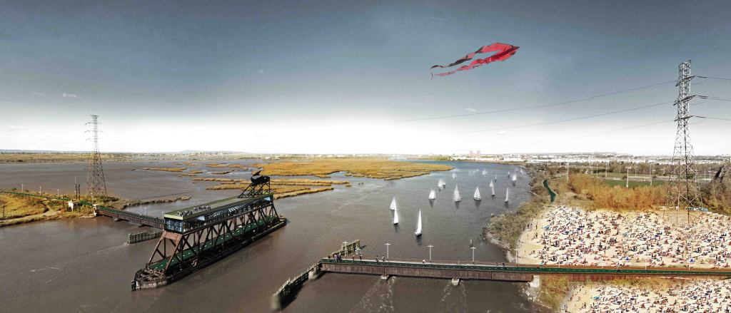
1. The New Jersey Meadowlands as Place
2.The Smart Barrier
What makes a flood barrier “smart”? According to Richard Baldwin of the Interboro Team, a smart barrier is one that has multiple uses. “It’s not just a dike,” he says. Most of the time, when there are no flood waters the barrier just looks like a stretch of parkland, or a landscaped bike, or a walking path. This is a recurrent theme in Rebuild By Design proposals; strong protection against storm surges doesn’t have to look like armor.
If you were going to design a city to be a proving ground for resilience strategies, it would be Hoboken. It’s a densely populated grid, originally a marshland, sitting on a little over a mile of Hudson River shoreline. Landscape architect Diana Balmori, working with the OMA team, said that the flood-prone city’s scale makes it an “ideal” case study. Her team has set out a smorgasbord of strategies from bulkheads and deployable floodwalls to keep water out, permeable paving stones and green roofs to slow runoff, cisterns and constructed wetlands to store excess water, and pumps and drains to move floodwater out into the river. Even the path of the Hudson-Bergen Light Rail Line becomes a conduit for flood water. Pretty much every water management strategy ever conceived will be be neatly packaged into Hoboken, the Mile Square City.
Tottenville, on Staten Island’s South Shore, was once known as “the town the oyster built.” The SCAPE/Landscape Architecture team proposes to defend the hard-hit Staten Island shore from flood waters by building a series of breakwaters and reefs, a sloping habitat of rock and concrete that “absorbs wave energy” while providing sheltered niches for fish, lobsters, and oysters. The breakwaters will slow future storm surges while revitalizing the underwater ecology. And the return of the oysters heralds cleaner water —and, perhaps, a shellfish driven economic revival.
The BIG U, a multifaceted array of flood protection strategies wrapping around the southern half of Manhattan, is, according to landscape architect Laura Starr, about “making infrastructure fun.” That means taking Robert Moses-era waterfront promenades and making them more lush and absorbent. “More Olmstedian,” in Starr’s view. But the most inventive suggestion borrows the structure of the FDR Drive along Manhattan’s east side, particularly in the flood-prone area near the South Street Seaport. The concept is that metal flood gates could flip down from the elevated highway when necessary and be sealed with a gasket at grade or below. Most of the time, the gates would be stored overhead and would serve as a long canvas for public artwork that you’d have to look up to see (“taking cues from the Sistine Chapel,” says Jeremy Alain Siegel, a designer at BIG).
Simple idea: If small businesses come back quickly after a storm, the surrounding community can also come back quickly. This proposal is about organizing business districts to implement improvements that make their neighborhoods better prepared for storms. Best suggestion: designate a stretch of Red Hook, Brooklyn, near where the Gowanus Canal enters New York Harbor, as the Makers’ District, where new industry could thrive in flood-proofed buildings and the community would have access to an elevated promenade.
No, they’re not exactly “artificial” in that they’re made of sand, just like regular barrier islands. And they’ll likely develop the ecologies that barrier islands used to have before we began paving them over. But these man-made islands will sit some six to 10 miles out to sea and be positioned according to sophisticated computer modeling technology to reduce the energy of storm surges. “The efficacy of this was looked through a series of three different storms,” notes WXY principal Claire Weisz. She says that Stevens Institute of Technology in Hoboken modeled how “surge and inland flooding” in recent events would have been lessened with the addition of another row of barrier islands.
If you convince the people to move where they’re safe, “the economy of New Jersey is also safe,” reasons Rutgers professor of ecology Steven Handel. His team argues that the Jersey Shore is deeper and wider than the beloved string of barrier islands, and that inland features such as the Pine Barrens and coastal lakes should considered as part of an expanded shore. He proposes an inland population shift that happens incrementally as, year by year, sea levels rise. Ultimately, a ferry system transports beachgoers from safe inland lodgings across the bays to ocean beaches.
Most New Yorkers don’t realize that Hunts Point in the Bronx, home to the city’s main wholesale produce market, fish market, and distribution center for the Food Bank of New York, is surrounded on three sides by water. It’s only luck that the city’s food supply didn’t get inundated during Sandy, according to Richard Roark of the landscape design firm OLIN. In this plan, a “micro-grid tri-generation energy strategy” supplies power—using photovoltaics and other sources—to keep food businesses open during disasters, while cutting back the diesel emissions that neighbor activists rally against.
This strategy for Bridgeport, Conn.’s largest city, known in recent years for crime and poverty, has everything all the other proposals have (lots of berms and breakwaters). But it also has something missing from the others: a proposed South End Resilience Education and Community Center, intended to serve its impoverished neighborhood’s 12,600 residents with all sorts of community services. According to the proposal, “the center provides uses ranging from workforce training and a fresh food co-op to a healthcare clinic, senior activities center, and child care.” And, in a neighborhood that could get cut off from the rest of the city by flooding, and where many people can’t easily evacuate because they don’t own cars, the community center is designed to serve as a shelter for 1,500 people, with its own off-the-grid power supply.