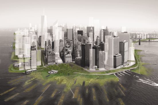
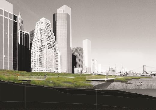
Courtesy Architecture Research Office and dlandstudio
In 2010, the Museum of Modern Art (MoMA) in New York staged an exhibit that struck some as alarmist. “Rising Currents: Projects for New York’s Waterfront” broke the New York area’s waterfront into five sections and asked architecture firms to offer proposals on how to mitigate the effects of rising sea levels specific to each area. But many New Yorkers don’t think of themselves as residents of a coastal city, the way that, say, New Orleanians do.
Now, in the wake of Sandy, the shockingly devastating storm that made landfall on Oct. 29, the concept seems prescient. Revisiting the exhibit, it seems that if the recommended measures had been taken the effects of Sandy, from flooding to power outages, might have been mitigated.
This week, media outlets such as The New York Times pondered whether New York should construct sea gates to keep out the rising tides. The MoMA exhibit recommended a very different course. Talking to some of the architects involved, a consistent theme emerges: the emphasis should be on soft rather than hard prevention techniques. In other words, instead of building a seawall—which would alter the salinity and ecosystem of the harbor—to keep water out, New York should try to work with the natural environment, a program of coexistence instead of confrontation.
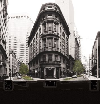
“We think that hard engineering solutions are the wrong approach. It creates a binary where either it works or it doesn’t,” says Stephen Cassell, AIA, a principal in Architecture Research Office (ARO), which partnered with Dland studio for the Lower Manhattan portion of the MoMA exhibit. “Soft infrastructure solutions are more resilient and can be layered on over time.” In Lower Manhattan, that would mean accepting that water will flood in—and creating a better mechanism for removing it quickly. To that end, ARO proposed to cover underground infrastructure such as power lines in waterproof vaults while creating adjacent underground channels to filter the water out. The streets would be made of porous concrete so that the water sinks into the channel and goes back out to the harbor, rather than backing up and flooding.
Buildings in Zones A and B would also have to move their electrical systems out of their basements to a higher floor. (This would have been a boon to the hospitals that had to evacuate this week because their backup generators were in their basements.) ARO also recommended making a softer edge for Manhattan island by adding a band of saltwater and freshwater wetlands. On the East River, that entails adding more landfill; on the Hudson, where so much land has already been added that there is a rather steep drop off in topography, they would actually carve inwards. At the Battery, Manhattan’s very southern tip, they would build a series of radial islands to break a storm surge’s momentum.
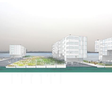
The same ethos guided other firms dealing with neighboring portions of the waterfront. “All the [different firms’] solutions dealt with making a more absorptive edge to create a buffer for low-lying land, and also thinking about new ways of inhabiting the water’s edge,” notes Marc Tsurumaki, AIA, and a principal in Lewis Tsurumaki Lewis Architects (LTL). LTL dealt with a western portion of New York harbor, including Liberty and Ellis Islands and Liberty State Park in the Jersey City, N.J., waterfront. Jersey City experienced severe flooding, and it is entirely possible that LTL’s proposal would have lessened it. Liberty State Park is, like Battery Park City, a flat area of landfill.
LTL proposed to transfer the landfill mass so that, instead of being flat and presenting a linear face to the water, it would have higher ground and jagged edges that would reduce the velocity of a storm surge. “Our solution was to stretch the edge back into the site,” Tsurumaki says. “We’d allow the harbor back into site and elongate the coastline, making it from its current 10 miles long to about 40 miles by stretching it into a series of channels and landscaped tiers, stretching back into a more complex shape. That would magnify the surface area of contact for land and water which is one of the major buffers [against flooding].”
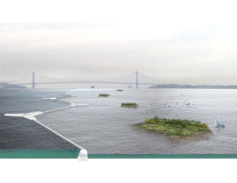
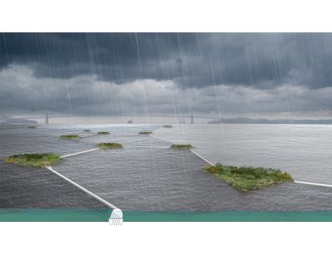
Another firm, nArchitects, took a similar, albeit more dramatic, approach to their section of the coastline, in southwestern Brooklyn and around Staten Island. “Instead of building gates and running for the hills, we asked, ‘How do we make it livable, resilient, ecological?’ ” says Eric Bunge, AIA, a principal at the firm. For inspiration, they looked abroad to places that have been living with a high risk of flooding for centuries, such as Holland and Japan.
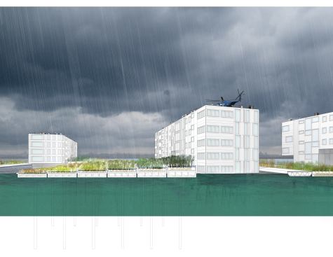
Using a technology that has been successfully deployed in those countries, nArchitects would deploy inflatable barriers. “They would have slowed the storm surge [in Sandy],” says Bunge. “They are intended for surges of up to 20 feet and this was 14 feet.” The firm recommended constructing mini-islands around the coastline that would attract sediment to create a more natural barrier as well. In their most daring proposition—some might say far-fetched—nARCHITECTS suggested that New York’s zoning code only allow buildings that hang from bridge-like superstructures, anywhere below 20 feet above mean sea-level.
Yet it would have seemed just as proposterous to suggest that whole parts of Manhattan would be dark or under water after a storm, before the arrival of Sandy. This storm is unlikely to be the last that poses this level of threat to New York. The vision that “Rising Currents” presented for New York is one in which architects take some of the latest and most prominent conceptual innovations from the field—resilience and adaptivity being the big ones—and apply them to the task of safeguarding New York. If this exhibit is any indication, New York won’t be adopting a levee system like the one that failed in New Orleans after Hurricane Katrina.
“Those big engineering projects can fail,” Bunge says. “Will ours work as well [as a levee] every time? Maybe not; it will get a little wet, but it will get people to think about [the water] in a new way.”