That sea levels will continue to rise is rarely disputed by (most) scientists. How coastal cities will protect their infrastructure is less certain. The Urban Land Institute’s Boston/New England chapter recently convened a charrette of local experts in development, finance, design, and insurance to propose long-term solutions for adapting Boston’s low-lying built environment—part of the fifth largest metro area in the U.S. in 2011—to manage the effects of climate change. Their ideas, published in a 52-page report released last week, span simple to complex and go so far as to suggest that a network of canals replace the winding alleyways of the city’s Back Bay neighborhood.
The report, titled “The Urban Implications of Living with Water,” is part of a current slew of research that assesses the damage wrought by Hurricane Sandy in 2012 and outlines resilient construction practices to better battle future extreme-weather events; perhaps more importantly, it also considers climate change’s more permanent environmental impacts. In Boston, where sea levels are predicted to rise in some areas by as much as 7.5 feet by 2100, a phased approach to resilient construction marked by incremental improvements is imperative, the report’s authors say.
“This is a change that’s coming whether we want it or not,” Dennis Carlberg, AIA, the sustainability director at Boston University and who contributed to the report, told the Boston Globe. “Instead of being afraid of the problem, we need to embrace it and think about opportunities it offers us.”
The group selected four typical sites in and around Boston as subjects of its assessment: the Back Bay, the Innovation District, Revere Beach, and the Alewife area of Cambridge.
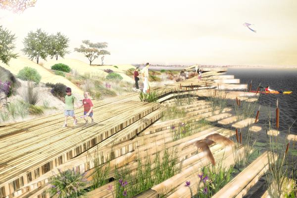
For the walkable, mixed-used Back Bay neighborhood—which sits atop an infill site less than 4 feet above the region’s current high-tide line—the report proposes integrating water management into the streetscape by turning its north–south streets and east–west alleyways into canals that connect to the Charles River via a series of locks. In Alewife and Revere Beach, an elevated concrete podium supporting residential and commercial projects is proposed to protect the buildings from water damage during storm surges while maintaining ocean views. And for the Innovation District, which contains the largest tract of undeveloped land in the city, the report proposes raising the HarborWalk boardwalk so it can absorb water and respond to shifting tides while also providing recreational public space.
Although the report’s suggestions, so far, are meant to be conceptual, they reflect an increased interest from the design community in resilient solutions for coastal zones. Following Hurricane Sandy, Perkins+Will rendered the hypothetical, 86,400-square-foot Floatyard multifamily project that is designed, as its name implies, to glide atop the Charlestown harbor near Boston, held in place amid tidal shifts by mooring columns. And last summer, the Boston Society of Architects and the Boston Foundation of Architecture joined city groups to commission a report recommending resilient construction practices for the city’s vulnerable zones.
The goal: to keep Boston above water by managing its inevitable impact.