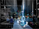
From transit‑oriented urban design to strategic site selection, architects and planners are rethinking how location, access, and performance shape the built environment.
Architects and urban planners are asked to design places that do more than look good or meet zoning requirements. Today’s projects must perform economically, socially, and environmentally over time. Whether planning a mixed‑use district around a transit corridor or evaluating a neighborhood site for a new community facility, one factor consistently influences long‑term success: location.
Historically, decisions about where to build, invest, or reinvest were often guided by intuition, precedent, or incomplete data. Transit access might be considered late in the design process, while site selection decisions were made at a parcel level without understanding broader patterns of movement, access, and demand. The result was often well‑designed places that struggled to attract users, support equity, or adapt as communities changed.
A shift is underway. Across architecture and urban planning, practitioners are using location‑based analysis to bring mobility, access, and performance into the earliest stages of decision‑making.
Why Access and Location Belong in Early Design
Urban form and movement are inseparable. Transit availability influences where density works, how mixed‑use developments perform, and whether places are genuinely walkable and inclusive. Strong access supports active streets and connected communities. Weak access can undermine even the most carefully designed environments.
Yet transit and accessibility considerations have long been fragmented across agencies and datasets, making them difficult to integrate into design workflows. When access is evaluated only at a district or corridor level, critical variations from block to block or building to building can be overlooked.
A more effective approach begins by evaluating accessibility at a finer grain. When designers can understand how transit service, frequency, and proximity differ across individual sites, they gain clarity about where certain uses will thrive and where barriers to access may limit opportunity.
From Sites to Systems: A Broader View of Performance
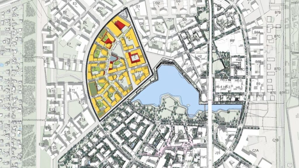
This location‑led thinking is not limited to urban districts or large‑scale plans. It is increasingly influencing how architects, planners, and advisors approach site selection for individual buildings and community services.
Rather than evaluating sites in isolation, design teams are stepping back to understand entire networks: where people live, how they travel, which locations underperform, and where reinvestment will have the greatest impact. Patterns emerge when sites are analyzed together, revealing gaps, redundancies, and opportunities that are invisible at a single‑parcel scale.
This systems‑level view supports better prioritization. Instead of defaulting to new construction, organizations can identify when reinvestment, renovation, or relocation better serves long‑term community needs. In many cases, data‑informed analysis challenges assumptions and prevents unnecessary capital projects while still supporting growth and access.
Designing with Equity and Everyday Experience in Mind
Accessibility is not just a technical metric. It shapes daily life. For residents without reliable access to a private vehicle, small differences in transit frequency or walking distance can determine whether jobs, healthcare, and education are realistically reachable.
When designers evaluate projects through this lens, new questions emerge: Who can use this place without a car? How does access change at night or on weekends? Which populations are advantaged or excluded by current location decisions?
Bringing these insights into design conversations helps teams align physical form with social outcomes. It also creates a shared foundation for collaboration between designers, planners, transportation agencies, and community stakeholders.
A Smarter Foundation for Urban Decision‑Making
As cities face pressures from growth, climate goals, and shifting work patterns, design decisions grounded in spatial understanding become essential. By combining building‑level accessibility analysis with network‑wide performance insights, architects and urban planners can design places that respond to how people actually move, work, and live.
Designing around location and access is no longer about intuition or compliance. It is becoming a practical framework for creating resilient, equitable, and high‑performing environments.
Putting This Tech to Use
As you approach your next planning or design project, step back from individual sites and ask a bigger question: How does this place perform within the larger system of movement, access, and opportunity? The answers may reshape not only what you design, but where and why you design it.
Discover real-world examples and practical strategies for integrating GIS into your practice in Esri’s Architecture eBook. Download it here and start designing with the power of place.